About
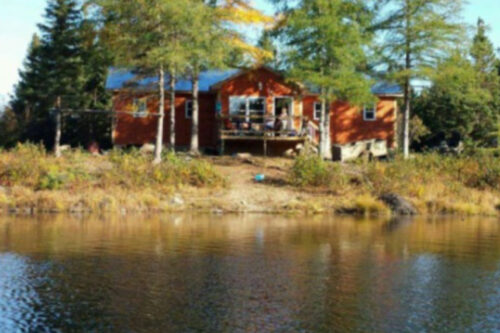
drive-in camp
WORLD CLASS HUNTING & FISHING
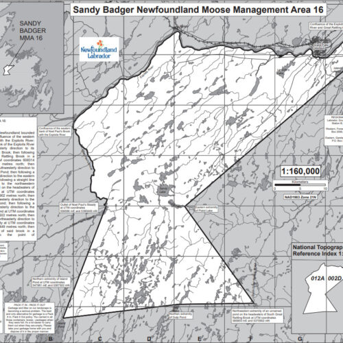
Sandy Badger - Hunting Area 16
2G Outfitters was founded by Clifford Vincent nearly a decade ago and continues to offer the world class Newfoundland hunting and fishing adventures that keep clients coming back year after year.
Come and enjoy not only the excitement of the hunt, but spectacular scenery, and Newfoundland hospitality in comfortable lodges at our Sandy Badger (Hunting Area 16) Drive-in Camp.
HUNTING AREA 16 (SANDY BADGER) - All that area of the Island of Newfoundland bounded by a line beginning at the confluence of the western bank of Noel Paul’s Brook with the Exploits River; then following the southern bank of the Exploits River in a northeasterly, then easterly direction to its confluence with Great Rattling Brook; then following the western bank of Great Rattling Brook in a southeasterly direction to UTM coordinates 608314 metres east and 5420444 metres north; then following a straight line in a southwesterly direction to the eastern extremity of Island Pond; then following a straight line in a southwesterly direction to the eastern extremity of Pistol Lake; then following a straight line in a southeasterly direction to the northwestern extremity of an unnamed pond on the headwaters of South Great Rattling Brook.
About
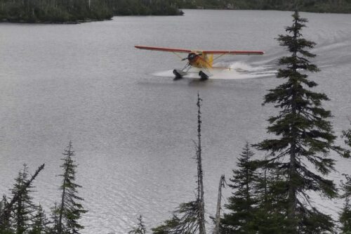
fly-in camp
WORLD CLASS HUNTING & FISHING
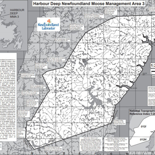
Harbour Deep - Hunting Area 3
2G Outfitters, since being founded, has provided world class hunting and fishing to their clients. This world class service has lead to rapid growth for the company. To respond to this growth, 2G Outfitters have expanded options to include a fly-in trophy hunting camp.
HUNTING AREA 3 (HARBOUR DEEP) - All that area of the Island of Newfoundland bounded by a line beginning at UTM coordinates 466410 metres east and 5513474 metres north on the Gros Morne National Park boundary; then following the Gros Morne National Park boundary in a generally northwesterly direction to UTM coordinates 461201 metres east and 5520574 metres north; then following the Gros Morne National Park boundary in a generally northerly direction to UTM coordinates 461821 metres east and 5531131 metres north; then following a straight line in a northeasterly direction to the confluence of unnamed brooks at UTM coordinates 464734 metres east and 5531834 metres north; then following a straight line in a northeasterly direction to the eastern bank of an unnamed brook at UTM coordinates 474676 metres east and 5548673 metres north; then following a straight line in a northeasterly direction to UTM coordinates 476288 metres east and 5550252 metres north; then following a straight line in a northwesterly direction to an unnamed peak at UTM coordinates 471484 metres east and 5560140 metres north; then following a straight line in a northeasterly direction to the summit of Gros Pate.
About
travel information
WORLD CLASS HUNTING & FISHING
driving or flying information
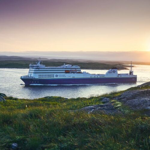
GETTING HERE BY VEHICLE AND FERRY: Located at the most easterly edge of North America, Newfoundland and Labrador makes for a great road-trip destination. Most car travellers access the province by Marine Atlantic ferries, which operate between Nova Scotia and the island of Newfoundland. These super-ferries carry hundreds of vehicles and passengers to two entry points. There is a year-round, daily service between North Sydney, Nova Scotia and Port aux Basques, in southwestern Newfoundland. Once you cross the Atlantic you will be in Port aux Basques where you would follow the Trans Canada Highway until you reach our location in Springdale, NL (approximately 400 kms). Click below for more information on ferry crossings.
Read More
travel information
WORLD CLASS HUNTING & FISHING
location map
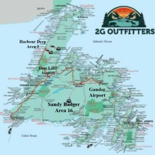
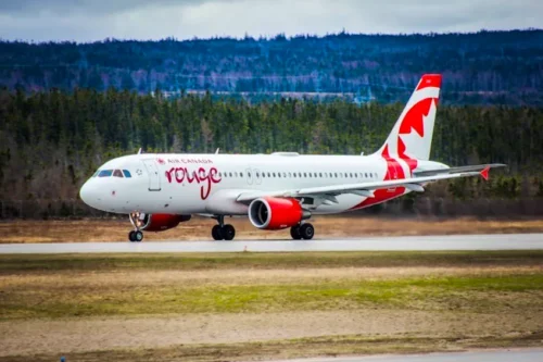
GETTING HERE BY AIR: Newfoundland and Labrador is served by both scheduled airlines and charter services, and can be reached via national and international connections. Our province is home to two international airports – located in St. John's and Gander – as well as domestic airports in Deer Lake. These airports are destinations for many major airlines, including Air Canada, WestJet and United Airlines as well as the locally-owned and operated Provincial Airlines. Helicopter Charter Services are also available with Newfoundland Helicopters. Typically our clients fly into Deer Lake airport which is approximately 130 kms away from our location or Gander which is approximately 200 kms away from our location. Click below for more information on air travel.